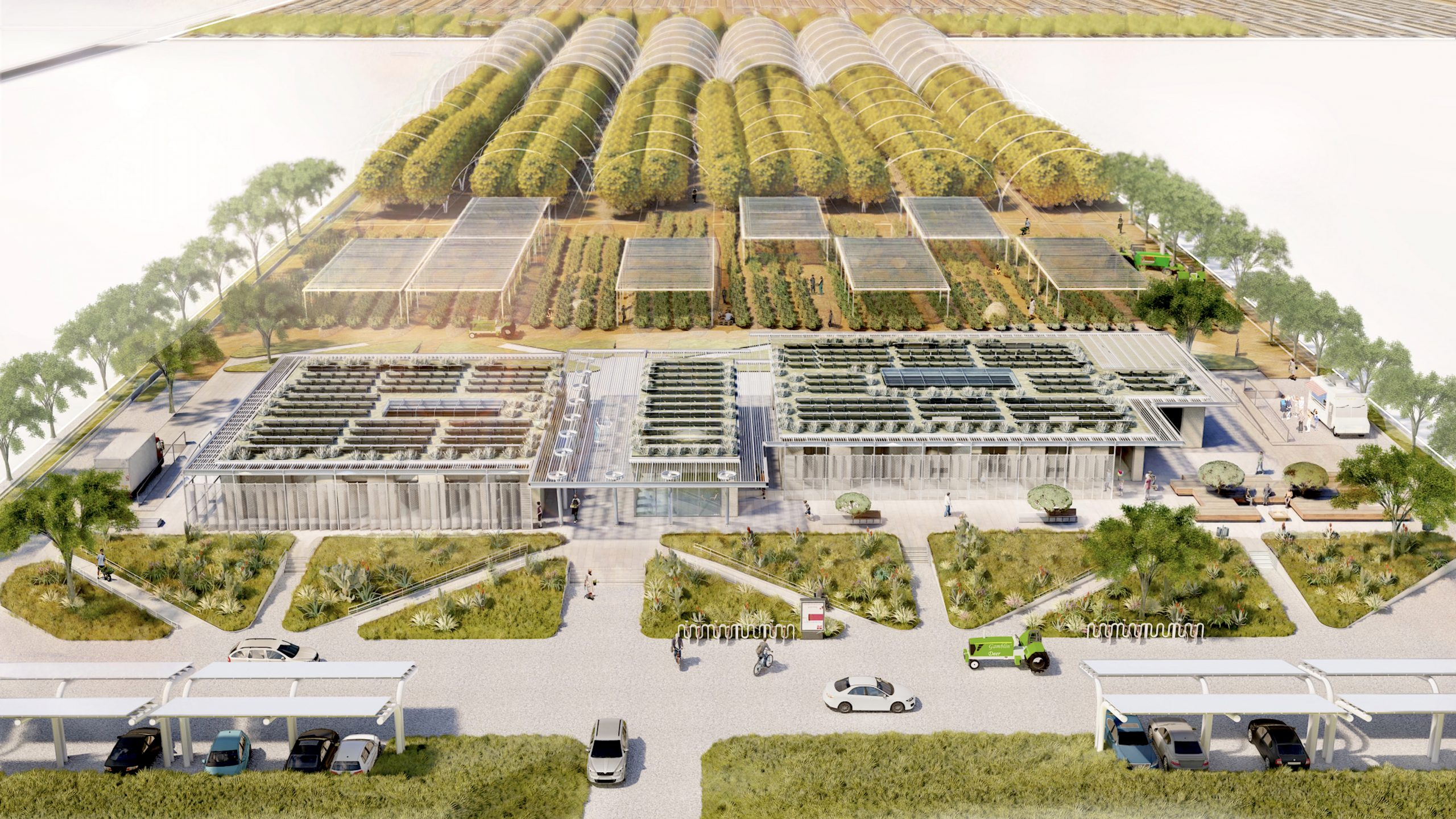


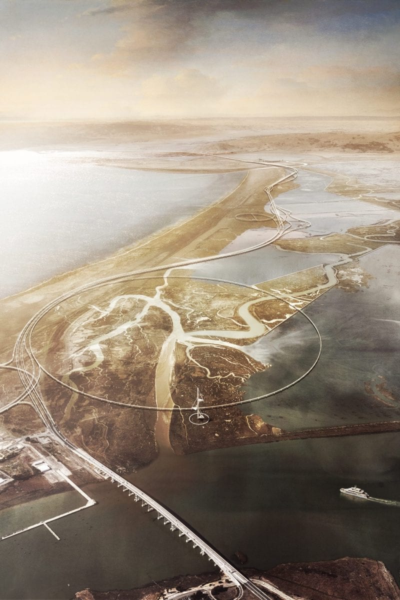
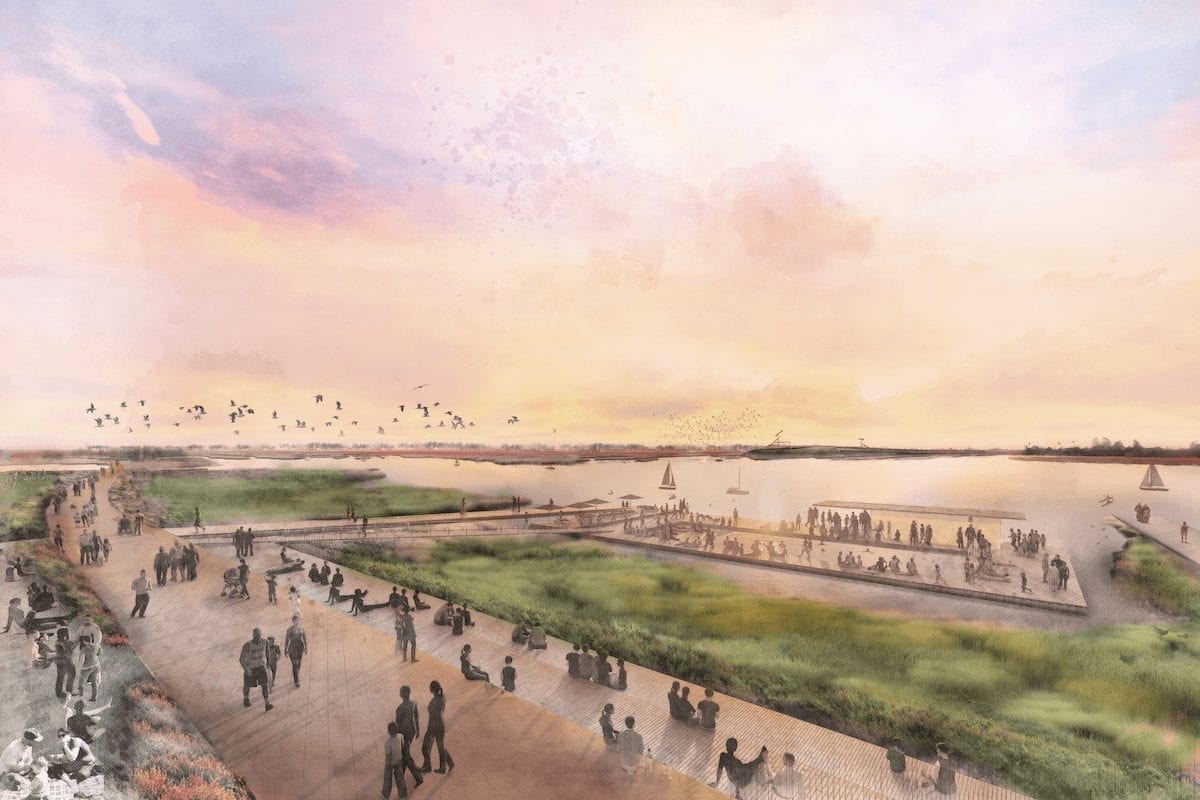
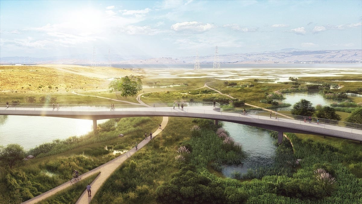
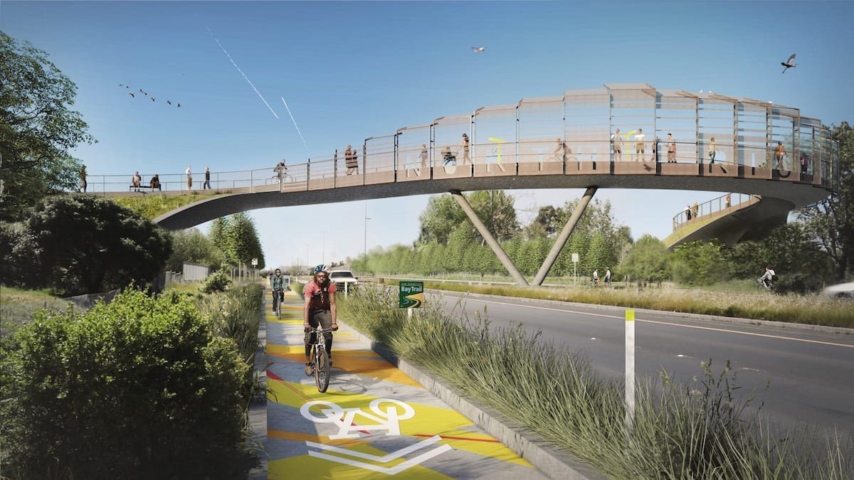
The Grand Bayway by Common Ground (image © TLS Landscape Architecture)
Courtesy: Resilient by Design
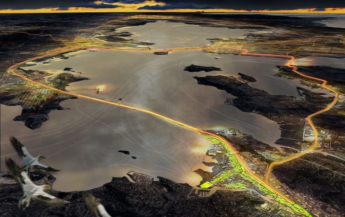
At a time when sea level rise is threatening coastal communities, California’s San Francisco Bay area, together with Miami and New York, would appear to be the most immediately threatened by this phenomenon. Assuming that levels in the Bay area can rise up to five feet by 2100, Resilient by Design, a local non-profit dealing with just those issues, launched a competition early this year to solicit ideas addressing the imminent dangers of flooding for coastal residents—and for the future of a fragile environment.
According to the sponsor, “Resilient by Design is different from other design competitions. The challenge is designed as a journey to foster collaboration and leadership while also addressing big challenges that face our communities in the future. The challenge provides an opportunity to advance the profession’s knowledge base in the rapidly evolving area of resilience while listening, engaging, and elevating the voices of residents and neighborhoods along the San Francisco Bay shoreline.”
The Bay Area Challenge began with a research phase, as the teams explored the Bay Area, looking closely at places nominate by the community as especially vulnerable to the threats of sea level rise, severe storms, flooding, and earthquakes. Throughout the fall of 2017, the Design Teams explored the Bay Area to study the intricacies of our unique region, from the effects of gentrification to the impacts of climate change, regional transportation challenges, and the unique cultural history of our communities. In January 2018, each team was matched by our Research Advisory Committee with a site in our region. Over the next four months, the Design Teams and community partners developed their solutions for tackling sea level rise and creating resiliency. Finally in May 2018 the Teams each revealed their innovative designs at a two day event that both celebrated the exciting new work and created a lift off for the work that must happen in the future to make these designs a reality.
The eleven-person jury was involved in the process from the start, “providing critical input at the Challenge launch and final Collaborative Design Phase. The Jury selected the participating Design Teams and reviewed the final designs at the conclusion of the Challenge.” Based on a generous grant—$250,000 per team—from the Rockefeller foundation, an RfQ attracted 52 expressions of interest from many of the most highly qualified designers. After the initial RfQ, the jury reduced the number of finalists to a shortlist of nine, based primarily on their track records.. They were:
- Elevate San Rafael (Bionic)
- Unlock Alameda Creek (Public Sediment)
- The Peoples Plan (P+SET)
- South Bay Sponge (Field Operations Team)
- Estuary Commons (ABC)
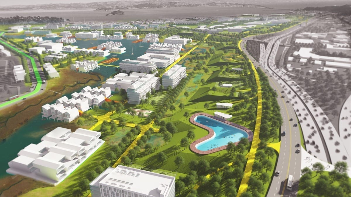
- The Grand Bayway (Common Ground)
- Connect and Collect (Hassell+)
- ouR-Home (Home Team)
- Islais Hyper-Creek (BIG+ONE+Sherwood)
Here it should be noted that mmany of the major landscape and design firms were among those on the shortlisted teams: Michael Maltzan, BIG, SCAPE/Landscape, Tom Leader, Claire Weisz, and Field Operations, just to note a few. Not only did each team have to produce plans, graphs, and renderings, their final presentations were videotaped for public consumption.
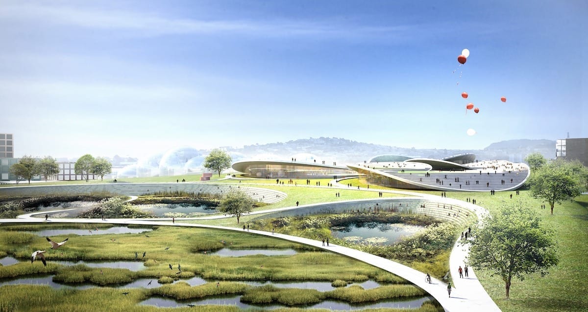
Many of the solutions might have been anticipated:
- Creating park- and marshland areas at water’s edge to avoid the common flooding that plagues coastline communities;
- When communities are threatened at water’s edge and beyond, elevate certain “safe” areas as refuges in case of disasters;
- Building levies in some isolated cases to protect communities in immediate danger of flooding;
- Elevate roads and walkways for both vehicular and pedestrian traffic as well as areas of communities;
- Creating affordable housing in unused areas remote from flooding, to relocate often at risk low income populations from flood-prone regions.
Involvement of the individual communities was a major theme in the competition program. Thus it was clear from most of the presentations that community input was regarded as a high priority.
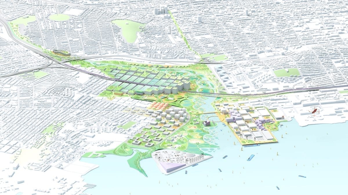
As important as these studies were, their implementation will necessitate funding and a considerable amount of political will for any of them to see the light of day—whether on the local, state, or national level. One example, which won special praise from the jury, was The Grand Bayway proposal, by the Common Ground team led by Tom Leader. It suggests an elevated State Route 37 in the San Pablo Bay area, creating a scenic route above the marsh area instead of its present location on top of a levee. Not just the cost, but getting all the stakeholders to cooperate on this venture would be a major accomplishment.
What Resilient by Design did was to bring the prospect of viable solutions to light and lend focus to an issue that has lately become a hot topic of conversation. To see the full presentation packages:
http://www.resilientbayarea.org/
Estuary Commons (ABC)
AECOM | CMG Landscape Architecture | University of California, Berkeley- College of Environmental Design | Berkeley Center for New Media | The Terner Center | California College of the Arts | IDEO | Silvestrum | SKEO | modem | David Baker Architects
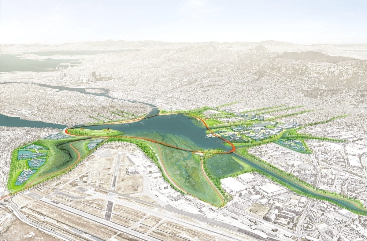
Images © AECOM
Islais Hyper-Creek (BIG+ONE+Sherwood)
BIG – Bjarke Ingels Group | ONE | Sherwood | Moffatt & Nichol | Nelson Nygaard | Strategic Economics | Dutra Group

Images © BIG
Elevate San Rafael (Bionic)
Bionic Landscape | WXY | PennDesign | Michael Yarne | Enterprise | Moffatt & Nichol | WRA | RMA | Romberg Tiburon Center, SFSU | Studio for Urban Projects | RAD Urban | Keyser Marston Associates
Images © Bionic Landscape
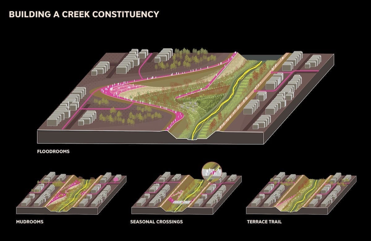
The Grand Bayway (Common Ground)
TLS Landscape Architecture | Exploratorium | Guy Nordenson & Assoc | Michael Maltzan Arch| HR&A Advisors | Sitelab Urban Studio | Lotus Water | Rana Creek | Dr. John Oliver | Richard Hindle, UC Berkeley | Fehr & Peers Transportation Consultants
Image © TLS Landscape Architecture
South Bay Sponge (Field Operations Team)
James Corner Field Operations | Moffatt & Nichol | Magnusson Klemencic Associates | SF BAY National Estuarine Research Reserve | Romberg-Tiburon Center, SFSF | Andrea Baker Consulting | James Lima Planning + Development | The Bay Institute | SeArc / ECOncrete | HT Harvey and Associates | Playhou.se | Adventure Pictures
Images © James Corner Field Operations
Connect and Collect (Hassell+)
HASSELL | Deltares | Lotus Water | Idyllist | Civic Edge Consulting | Goudappel | Page & Turnbull | HATCH | Brown & Caldwell


Images © HASSELL
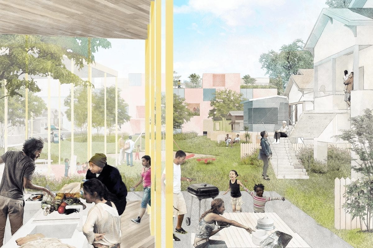
ouR-Home (Home Team)
Mithun | Chinatown Community Development Center | ISEEED/Streetwyze | BioHabitats | Integral Group | HR&A Advisors | Moffat & Nichol | ALTA Planning | Urban Biofilter | Resilient Design Institute
Images © Mithun
The Peoples Plan (P+SET)
Pandora Thomas | Antonio Roman-Alcala | Urban Permaculture Institute | Ross Martin Design | Alexander J. Felson, MLA, PhD, Yale School of Architecture
Images © Pandora Thomas
Unlock Alameda Creek (Public Sediment)
SCAPE Landscape Architecture | Arcadis | Dredge Research Collaborative | TS Studio | UC Davis Department of Human Ecology and Design | UC Davis Center for Watershed Sciences | Buoyant Ecologies Lab
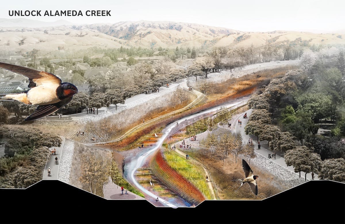

Images © SCAPE Landscape Architecture